Recording and Mapping
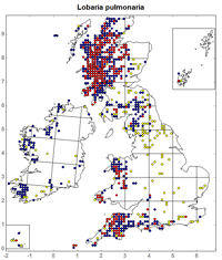
 Over the past 50 years BLS members have collected nearly 1.5 million lichen records, a valuable resource of information that can be used to support lichen research and conservation in many ways. Over the years these have included:
-
identifying the most important lichen sites, many of which are now designated as SSSIs or managed as nature reserves
-
monitoring changes in distribution over time as atmospheric pollution levels have changed
-
mapping lichen distributions and studying their ecology, to inform the conservation of both species and habitats
-
assessing the rarity and threat status of each species, published as the Conservation Evaluation of British Lichens (Woods & Coppins 2003, 2012) and also resulting in the selection of species for the Biodiversity Action Plan and for legal protection under schedule 8 of the Wildlife and Countryside Act (1981).
We have two databases to serve different purposes. The Mapping Scheme was established in 1963 and is still ongoing. We now also have a modern database that holds more detail of each record, including the location, grid reference, date, recorders and substrate, and allows them to be extracted and analysed in different ways. Records are organised into datasets which may be analysed separately or together, and when they have been reviewed they are made available on the internet through the NBN Gateway. We have recently completed a 10 year project to computerise all the records we hold, from the period 1960-2011. New records to add to this database are always welcome - see Contributing Records